GEO Tagging with Photo Supreme
Choosing Between OpenFreeMaps and Google Maps
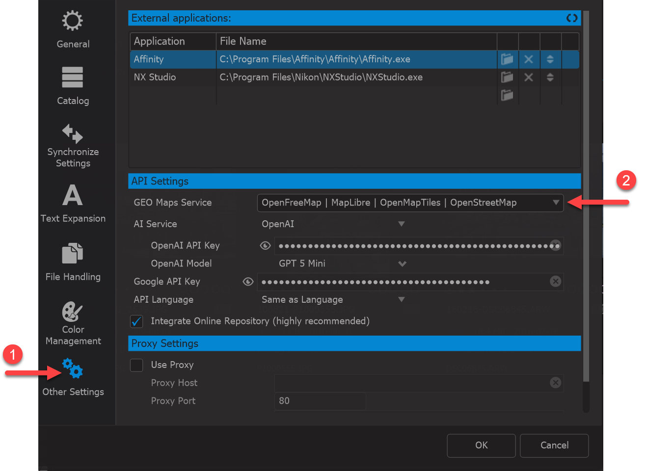
Photo Supreme allows you to select between two map providers: OpenFreeMaps and Google Maps. Each option has its own strengths, and the best choice depends on your needs, workflow, and environment.
When to Choose OpenFreeMaps
OpenFreeMaps is the default map provider in Photo Supreme and is suitable for most users.
Choose OpenFreeMaps if:
- You want a free, zero-setup solution
OpenFreeMaps works out of the box and does not require accounts, API keys, or configuration. - You prefer open data and open technologies
OpenFreeMaps uses MapLibre/OpenMapTitles with data from OpenStreetMap, making it an excellent choice for users who favor open-source and community-driven projects. - Your needs are basic to moderately advanced
For viewing geotagged photos, browsing locations, and performing standard map-based searches, OpenFreeMaps provides all essential functionality. - You want predictable usage without quotas or billing
There are no usage limits, billing concerns, or risk of service interruptions due to exceeded quotas.
For most personal collections and many professional workflows, OpenFreeMaps offers everything required with minimal complexity.
When to Choose Google Maps
Google Maps is a powerful commercial mapping platform that may be preferred in specific scenarios.
Choose Google Maps if:
- You require highly detailed or familiar map visuals
Google Maps offers extensive global coverage, frequent updates, and map styling that many users are already accustomed to. - You rely on Google-specific features or accuracy
In some regions, Google Maps may provide more detailed street data, points of interest, or satellite imagery. - You already use Google Cloud services
If you have an existing Google Cloud account and are comfortable managing API keys, quotas, and billing, integrating Google Maps may be straightforward. - You need consistency with other Google-based tools
Workflows that depend on Google Maps in other applications may benefit from using the same provider in Photo Supreme.
Keep in mind that Google Maps requires a valid Google Maps API key and an active Google Cloud account. Usage may be subject to quotas and potential costs, depending on your Google Cloud plan.
Summary
- OpenFreeMaps is the recommended choice for most users: free, easy to use, and maintenance-free.
- Google Maps is best suited for users who need its specific strengths and are willing to manage the required setup and potential costs.
You can switch between map providers at any time, allowing you to choose the option that best fits your current needs.