GEO Tagging with Photo Supreme
GEO information on thumbnails
Once you have GEO-tagged images, you can easily display this information on your thumbnails using Custom Thumbnail Information. Here’s how to do it:
- Click the Thumb Button in the Settings Bar located beneath the thumbnails.
- Check the option for “Show custom thumb info.”
- In one of the lines, click the dropdown arrow on the right.
- Select “Image.”
- Choose “Image Has GPS.”
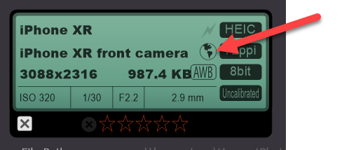
This will display a “Yes” or “No” on the thumbnails, indicating whether the image contains GEO coordinates.
TIP: The Info Panel also features a GPS Indicator that lights up if the selected image has GEO coordinates.