
GEO Tagging with Photo Supreme
Integrating GEO Tagging with Catalog Labels
Catalog Labels in Photo Supreme act as "tags" for your images, often representing content like people, places, or events. Some of these labels may correspond to physical locations, such as:
- A place, city, or neighborhood (e.g., "Staten Island")
- A specific landmark (e.g., "Space Needle")
- An object (e.g., "Tower")
- A tourist attraction (e.g., "Times Square")
Photo Supreme allows you to assign GEO details to a Catalog Label. When that label is applied to an image, the GEO coordinates are added to the file during synchronization. This feature is useful when you don't have GPS coordinates but still want some level of GEO tagging.
To add GEO details to a Catalog Label, either create a new label or open the details of an existing label (right-click on the label and select Details).
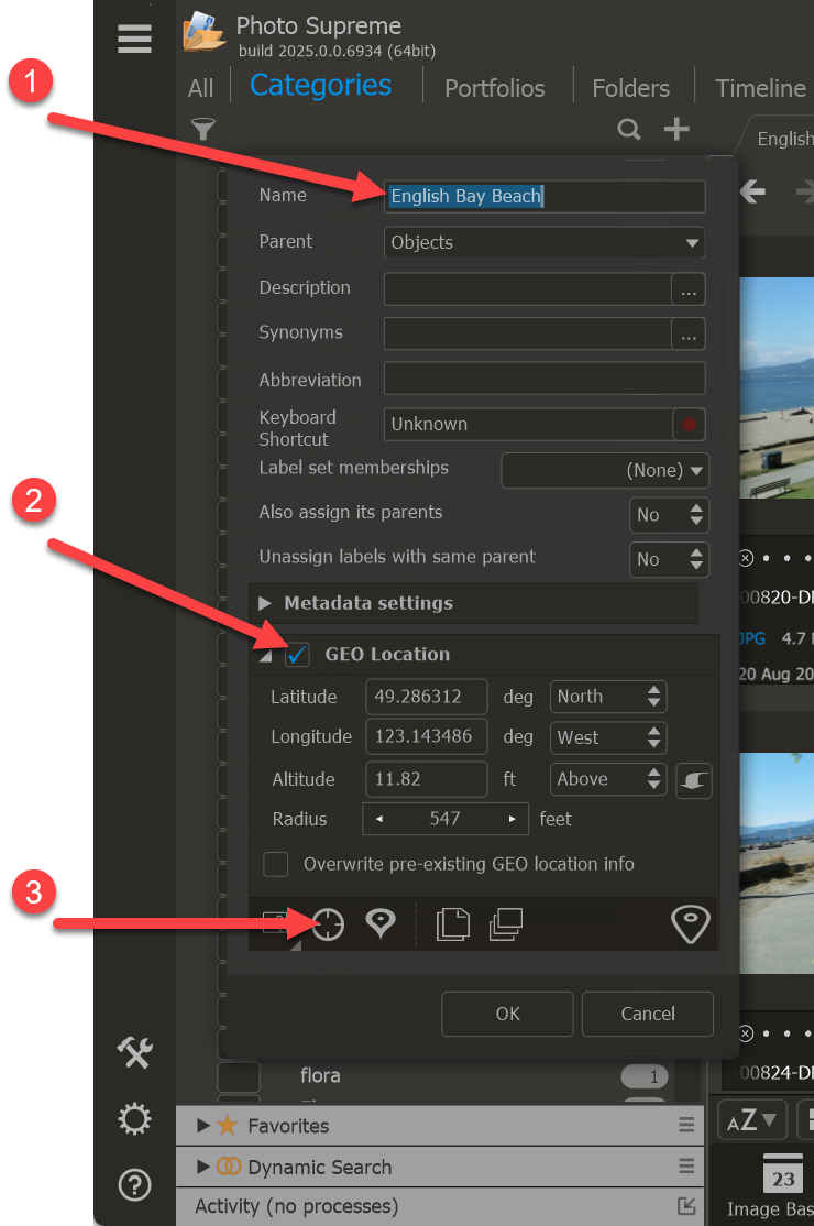
The easiest way to retrieve coordinates for a Catalog Label is by using the "Lookup" button. This feature will use the details you've already entered to find the corresponding coordinates. For example, when creating a Catalog Label for the English Bay Beach in Vancouver, you can enter this in the Lookup option to perform a forward lookup (retrieving the coordinates for a location). The system will instantly find the location, and the coordinates will automatically be filled in.
Alternatively, you can enter the coordinates manually, copy/paste them from the GEO Panel, or copy/paste coordinates from Google Maps.
One important setting to note is the "Overwrite pre-existing GEO location info" checkbox. If this is checked, applying the Catalog Label to an image that already has coordinates will overwrite those coordinates when the metadata is saved. In most cases, you’ll want to leave this unchecked to protect any previously recorded coordinates.
Once you're done, click Apply. The Catalog Label is now GEO-tagged and can be assigned to your images. When you assign the label to an image, the GEO tags will be written to the image metadata during synchronization. If you’ve added coordinates to a Catalog Label that already has images associated with it, and you want these coordinates to be updated in all the files, select all the images under that label, right-click on a thumbnail, go to Metadata, and select Save Metadata to File.